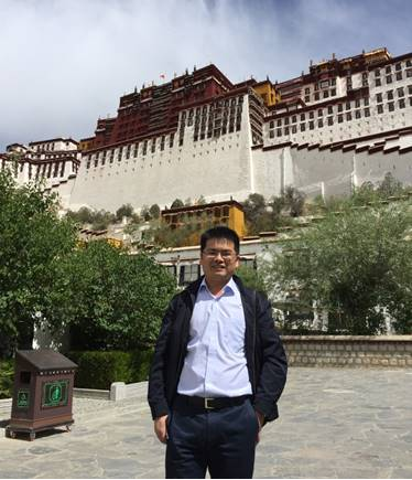
Gong Jian
Gong Jian (1977-), male, professor, doctoral supervisor/postdoctoral co-supervisor, is currently the deputy dean of the School of Public Administration, mainly engaged in the teaching and research of land evaluation, land-use planning and land information system. Research interests: multi-scale land use and cover/driving mechanism of land use change and spatial simulation, land price influence mechanism and spatial diffusion effect, land spatial planning, with more than 40 scientific research papers published. More than 40 provincial and ministerial scientific research projects supported by the National Natural Science Foundation of China, National Natural Social Fund of China and national “multiple compliance” pilot program as the project leader; one grand award for progress in geographic information technology at provincial or ministerial level, one second-class award for progress in science and technology and provincial and ministerial level, one provincial first prize for teaching achievements; executive director of Hubei Land Institute, member of the Professional Committee on Territorial Spatial Planning of China Society of Natural Resources, member of the Professional Committee on Land-use Engineering of Chinese Society of Agricultural Engineering, certified land appraiser, and certified real estate appraiser.
I. Education background
2004-2009: PhD, Wuhan University
2002-2004: Master, Wuhan University
1996-2000: Bachelor, Wuhan Technical University of Surveying and Mapping
2012-2013: Visiting scholar, The University of North Carolina at Charlotte
II. Teaching experience
Courses offered for undergraduates: Real Estate Appraisal, Introduction to Land Science, and Land-use Planning. Courses offered for master and doctoral students: Frontier of Land Science, Land-use Planning. Course design and field practice of Land Resource Management; leader of the teaching program “Course design of real estate appraisal based on case teaching; 1 First-class Teaching Achievement Award of Hubei Province. The undergraduates and postgraduates have published many papers under his instruction.
III. Scientific research
Selected research papers and monographs
1. Patch-based cellular automata model of urban growth simulation: Integrating feedback between quantitative composition and spatial configuration. Computers, Environment and Urban Systems, 79 (2020): 101402. SCI/SSCI
2. Carbon Dynamics in the Northeastern Qinghai-Tibetan Plateau from 1990 to 2030 Using Landsat Land Use/Cover Change Data. Remote Sensing, 2020,12(3). SCI
3. Land Use Classification System and Governance for Unified Management of Natural Resources. Planners, 2020 (10): 42-49.
4. Stationary and systematic characteristics of land use and land cover change in the national central cities of China using intensity analysis: A case study of Wuhan City. Resources Science, 2019, 41(4): 701-716.
5. Land Use and Land Cover Change in the Qinghai Lake Region of the Tibetan Plateau and Its Impact on Ecosystem Services. International Journal of Environmental Research and Public Health.2017, 14(7), 818-837.SCI
6. Property Rights of Urban Underground Space in China: A Public Good Perspective. Land Use Policy. 65 (2017) 224-237. SSCI
7. Impacts of the Qinghai-Tibet Railway on Accessibility and Economic Linkage of the Third Pole. Sustainability .2018, 10(11), 3982.SSCI
8. The Spatial Conduction Paths of Housing Prices of Urban Agglomeration in Yangtze River Delta. Economic Geography, 2017, 37(07):90-98.
9. Complex land use changes simulation in Ezhou City using cellular automata based on least squares support vector machine. Resources Science, 2016, 38 (8): 1525-1537
10. Modeling the Spatial Expansion of Urban Agglomeration Considering Their Spatial Interaction: A Case Study of Wuhan Metropolitan Area. Geomatics and Information Science of Wuhan University, 2016, 41 (4)
11. The Empirical Research on Process Evaluation of Land Intensive Use in China. Economic Geography, 2016, 36(5)
12. The Reconstruction of the Planning System in the Perspective of “Multiple Plan Integration” in China. Urban Planning Forum, 2016, 2.
13. Spatially Explicit Landscape-Level Ecological Risks Induced by Land Use and Land Cover Change in a National Ecologically Representative Region in China. International Journal of Environmental Research and Public Health. 2015,12,14192-14215. SCI
14. A case-based cellular automation model for simulating changes in rural residential areas. Resources Science, 2015, 37 (9)
15. National Economic Evaluation on Land Consolidation Project. China Land Science, 2013 (12): 80-86.
Works
[1] Real Estate Appraisal Theory and Practice. Shanghai: Fudan University Press, 2006.12. co-editor
[2] Grading and Evaluation Theory and Practice of Agricultural Land. Beijing: China Land Press, 2007.6. co-editor
[3] Strategic Research on Land Consolidation and Improvement in Qinghai Province, Beijing: China Land Press, 2013.12. co-editor
[4] Multiple Plans Integration: The Evolution of Planning Systems and Planning Institutions, Wuhan: China University of Geosciences Press, 2016.12, chief editor
Selected scientific research programs
1. Social ecological risk identification and adaptive governance of land spatial evolution in central cities. General program of National Natural Science Foundation of China, 2021-2024, PI
2. Research on the influence mechanism and spatial diffusion effect of housing price in urban agglomeration. General program of National Social Science Fund of China, 2014-2017, PI
3. “Multiple Plans Integration” Pilot Planning. Four ministries and commissions including National Development and Reform Commission and Ministry of Land and Resources, 2015-2016, PI
4. A special study on territorial spatial planning of Hubei Province, Department of Natural Resources of Hubei Province, 2019-2021, PI
5. A special study on territorial spatial planning of Qinghai Province, Department of Natural Resources of Qinghai Province, 2019-2021, PI
6. Territorial spatial planning of Datong County, Qinghai Province, Bureau of Natural Resources of Datong County, Qinghai Province, 2020-2021, PI
7. Comprehensive analysis of added cultivated land in the second national land survey, Chinese Land Surveying and Planning Institute, 2015-2016, PI
8. Modification and improvement of the general plan for land use of Ezhou City, Ezhou Bureau of Land and Resources, 2016-2017, PI
9. Study on the classification of planning land for natural unified management, Chinese Land Surveying and Planning Institute, 2017, PI
10. Research on land price diffusion: a case study of Yangtze River Delta, Chinese Land Surveying and Planning Institute, 2010-2011, PI
11. Empirical study on the relationship between house price and land price , Chinese Land Surveying and Planning Institute, 2010-2011, PI
12. Research on spatial optimization decision model of land use based on complex geographic computing, program supported by the Fundamental Research Funds for the Central Universities, 2011-2013, PI
13. Estimation of economic compensation for land expropriation and the rights and interests protection mechanism for land lost farmers, the National Social Science Fund of China (12CGL065), second participant
14. Land and resources investigation, evaluation, planning and deployment (121201097005), Ministry of Land and Resources, 2009-2010, participant
15. Agricultural land grading, evaluation and productivity accounting in Hubei Province, Hubei Provincial Department of Land and Resources, 2012-2013, PI
16. Study on the compensation mechanism of cultivated land protection in Hainan Province, Hainan Provincial Department of Land and Resources, 2014-2015, PI
17. Land consolidation planning of Qinghai Province, Qinghai Provincial Department of Land and Resources, 2010-2012, PI
18. Renewal evaluation and grade monitoring of cultivated land quality in Qinghai Province, Qinghai Provincial Department of Land and Resources, 2015-2017, PI
19. Overall land use planning of one prefecture and four counties in Haibei Prefecture of Qinghai Province, Qinghai Institute of Land and Resources Planning, 2009-2012
20. A study on the overall planning of land use in Henan Province, Henan Institute of Land and Resources, 2005-2007, PI
Awards:
General planning of tourism development in Qingjiang River Basin and planning of priority investment and development projects, Second-class Award for Progress in Science and Technology of Hubei Province, 2006
Cultivation mode and innovation of land resource management talents on the platform of brand specialty construction, the First Prize of Teaching Achievement Award for Colleges and Universities in Hubei Province, 2013
Key technology and application of big data aided multiple plans integration, 2018 Grand Award for Progress in Geographic Information Technology, 2018
Contact information:
E-mail: gongjian@cug.edu.cn, Tel: 027-67883088.
Copyright © 2012-2014 School of Public Administration
Address: No.388 Lumo Road, Wuhan, P.R. China
ZIP Code: 430074
Telephone:027-67883223