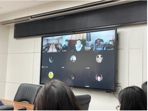
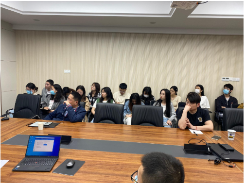
On the afternoon of March 16, 2022, at the invitation of Professor Gong Jian, Deputy Dean of School of Public Administration, two senior engineers from China Land Surveying and Planning Institute, Zhu Guohua and Wang Jin, gave an online academic presentation on "Technology and Methodology of the Third National Land Survey" and "Application of Remote Sensing Monitoring Technology and Method for National Land" to the teachers and students of the Department of Land Resources Management respectively. The presentation focused on the Third National Land Survey and discussed the technical methods and practical cases of the Third National Land Survey and Monitoring. The presentation was hosted by Professor Zhu Jianghong, Deputy Dean of School of Public Administration.
Starting from the main technical process and specific technical means of the third national land survey, Senior Engineer Zhu Guohua discussed in detail the working process and main achievements of the third national land survey, shared the key contents and technical details in the third national land survey, such as orthophoto map production, internal interpretation, field survey evidence, county-level database construction, internal and external verification, and systematically analyzed the key issues such as the connection between the third survey and the second survey, the determination of the survey boundary, and the achievement database construction, and introduced the application of online verification technologies such as "Internet+" and "Land Survey Cloud" in the third national land survey.
Starting from the background and significance of remote sensing monitoring, Senior Engineer Wang Jin elaborated the main tasks, basic data acquisition, DOM production, remote sensing monitoring information extraction and results remittance of remote sensing monitoring in the third national land survey. He also showed how remote sensing monitoring supported the important work of the Ministry of Natural Resources, such as annual land change survey, annual law enforcement of satellite land image and "one map" comprehensive supervision, under the background of large volume of tasks, tight schedule and strict quality control. At the presentation, teachers and students had in-depth discussions and exchanges with the two senior engineers on related topics.

Copyright © 2012-2014 School of Public Administration
Address: No.388 Lumo Road, Wuhan, P.R. China
ZIP Code: 430074
Telephone:027-67883223